
Our project
Campaign management map
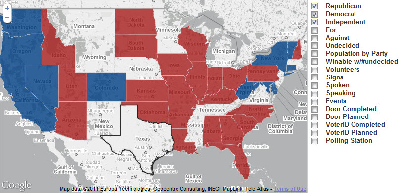
We built a campaign map so a field team could see party, support, volunteers, events, and door and voter contact.
What the map is for
The portfolio image is a national map with a layer list a field team would actually toggle: party, support, population, volunteers, signs, speaking, events, doors planned and completed, voter contact, and polling places. The work is geographic operations, not a static chart.
We do not name the campaign, and we do not claim a vote total or a win. We built the map so a team could see where the work was and where it was not.
Related work
Acuity operations dashboard · Sales and reporting portal
Talk with us about a similar system, or return to the full portfolio.